Underwater Surveys
2D Imaging
IMAGES generated with the use of the latest sonar technology is an excellent tool for deployment when water conditions present poor visibility or high flow rates.
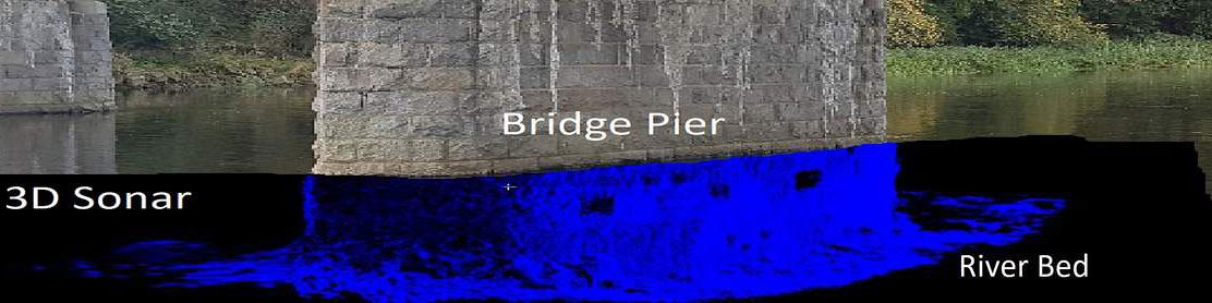
Asset management of critical marine infrastructures such as bridges, water control structures, marine retaining walls can rapidly be surveyed using sonar technology. Critical points of compromise can be identified and, in some cases, quantified.
3D Point Cloud Data
With survey projects that require volumetric calculations on detailed structures, 3D point cloud data is the sonar technology.
The data can be used to establish a structural baseline for monitoring and for project planning.
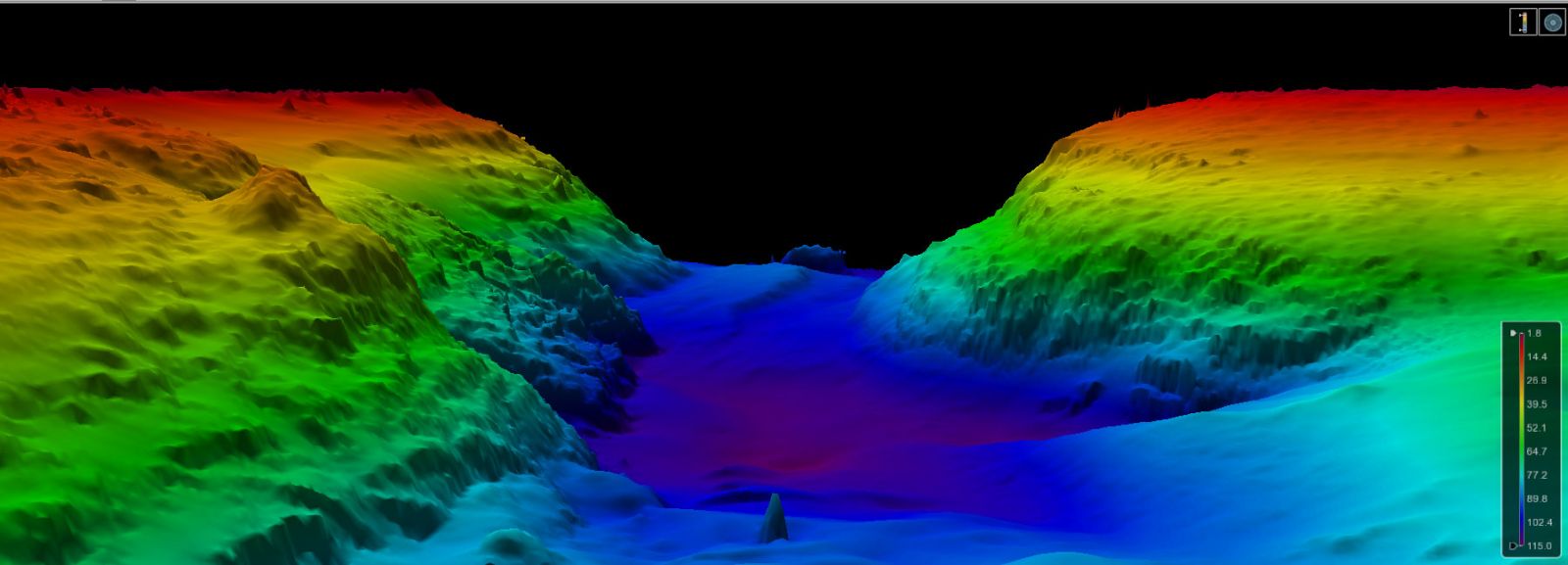
Bathymetry
Bathymetry data, when collected in high resolution, works extremely well for general underwater mapping, proposed pipeline route, search & recovery and scour detection.
CONTACT Diving Dynamics to review your project requirements and determine which sonar technology is the right fit.